
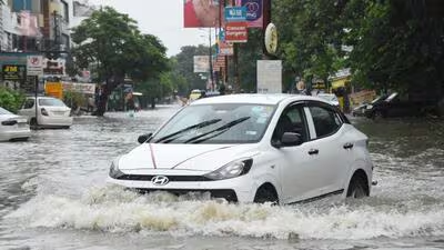
The monsoon made its presence felt in a big way as the season’s heaviest rainfall lashed Lucknow on Sunday. In 24 hours, the state capital received 40.9 mm of rainfall till 8.30am on Sunday, the highest rainfall recorded in the city this monsoon season so far, according to India Meteorological Department (IMD) officials.
Other locations in Lucknow also recorded significant rainfall, with Janeshwar Mishra Park receiving 51.5 mm, Sadar tehsil 39 mm, Ambedkar Park 81 mm, Chinhat 78 mm, Jan Bhavan 49 mm and BKT 49 mm. As it poured heavily, the rain deficit in the state capital dropped from 30% on August 15 to 21% within 24 hours. Since June 1, Lucknow has received 341.1 mm of rainfall against a long-period average of 433.5 mm, a deficit of 21%. Overall, Uttar Pradesh has recorded 381 mm of rainfall since June 1 against a long-period average of 488.9 mm, a deficit of 22%. East UP has received 366.7 mm of rainfall against the normal 519.2 mm, a deficit of 29%, while the West UP region has received 400.1 mm against the normal 446.5 mm, a deficit of 10%.
The readings indicate that southern parts of Lucknow received more rain than the northern parts of the city. “However, readings from these stations do not account for the overall rainfall in the district. However, the distribution remains uneven, with western UP faring significantly better than its eastern counterpart.
These are automated weather systems installed for other purposes and do not determine the state capital’s overall rainfall,” said Atul Kumar Singh, senior scientist at the Regional Meteorological Centre in Lucknow.
The monsoon trough is extending southeastwards into the east-central Bay of Bengal from a well-marked low-pressure area over Moradabad, Lucknow and Varanasi. An upper-air cyclonic circulation is persisting over southeast Uttar Pradesh and adjoining areas. Under the influence of these weather systems, heavy to very heavy rainfall is very likely over the state in the coming days. Heavy to very heavy rainfall accompanied by thunder and lightning is also very likely over some districts of the state. These include Ayodhya, Badaun, Bahraich, Barabanki, Bareilly, Fatehpur, Ghazipur, Gonda, Hardoi, Jaunpur, Kanpur City, Lakhimpur Kheri, Moradabad, Pilibhit, Rampur, Sambhal, Shahjahanpur, Sitapur and Varanasi, among others.
A well-marked low-pressure area (LPA) was located over the northwest Bay of Bengal and adjoining West Bengal-North Odisha coasts on August 16. It is likely to move northwestwards and intensify into a depression during the next 24 hours. The Regional Meteorological Centre has issued an orange alert for 24 districts where there is a high probability of heavy to very heavy rainfall on Monday.
The monsoon trough is likely to bring heavy to very heavy rainfall, with widespread rain expected in the region, according to officials.
