
New Delhi
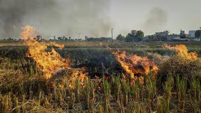
The Commission for Air Quality Management (CAQM) in National Capital Region and Adjoining Areas has asked the Indian Space Research Organisation (Isro) to improve accuracy in analysing burnt areas with regard to stubble burning, and differentiate between “high”, ”medium” and “low” intensity fires by making changes to its methodology and models, officials aware of the matter said.
Air quality in Delhi-NCR starts worsening from mid-September, with stubble burning the usual precursor to winter pollution. IARI, through its CREAMS laboratory, publishes the daily fire event data for Haryana, Delhi, Punjab, Uttar Pradesh, Madhya Pradesh and Rajasthan, based on this protocol. However, the data being generated, particularly the fire counts, has been in question, with several studies noting that farmers were burning fields late in the evening to avoid being captured by satellite imagery.
A standard protocol for estimation of crop residue burning events using satellite data was developed by Isro in consultation with state remote sensing centres and the Indian Agricultural Research Institute (IARI) in August 2021. Instances of stubble burning are usually logged from September 15 to November 30. India’s polar orbiting satellites complete their overpass and capture crop burning incidents typically between 10.30am and 1.30pm.
