O n September 11, 1803, on the banks of the Yamuna at present-day Patparganj in East Delhi, the British East India Company forces defeated the Maratha army and gained control of Delhi. It was a decisive turning point in the city’s history. The battle marked not only a shift in political power but also the beginning of a new phase of surveying, mapping and appropriation of Delhi’s rural landscape.
At the beginning of the 19 th century, Delhi was dotted with distinct ecological zones. The fertile khadar stretched along the Yamuna, while the pahari tract occupied the natural triangle formed by the Aravalli hills to the north, south and south-east, with the river defining its eastern boundary. To the south-west lay the low-lying dabar around the Sahibi river, while the fertile agricultural plains of the bangar marked the north-west. These zones were home to village communities whose livelihoods centred on cultivation and animal husbandry, with cattle, camels and goats forming part of everyday rural life.
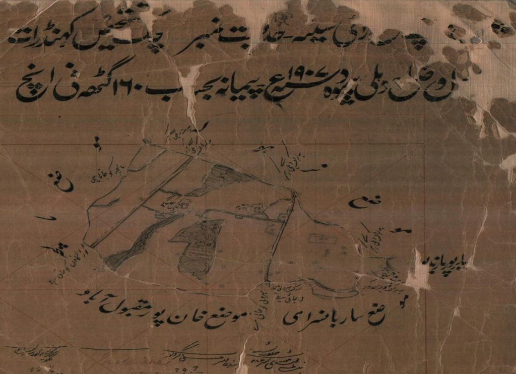
Read alongside the shajra nasab , jamabandi and khatauni , which documented lineage, land rights, ownership and cultivation accounts, these records revealed patterns of settlement, landholding and kinship. For centuries, these agrarian settlements supplied food, labour, water, military recruits, artisans and cultural traditions to successive urban centres. These settlements were not peripheral to Delhi’s history. They were part of what made the city possible. Siraspur, now in North Delhi near Samaypur Badli and Rohini, survives as a reminder of this once-extensive rural hinterland. But Delhi’s villagers were never simply anonymous cultivators. They had their own systems of landholding, cultivation, kinship, lineage and customary rights, supported by institutions of village life. Bhats preserved these histories through genealogies that recorded ancestry, settlement and links between families and land. Gradually, however, colonial records — shajra naksh, khasra and settlement registers — became the state’s official records of land and rights. Around a quarter of the recorded land was held as common land, supporting grazing and other collective needs. As these commons were later classified, divided and transferred, the change was not merely administrative. It reshaped the relationship between Delhi’s village communities, their land and the collective resources on which rural life depended. Every map broadly divided village land into three types: abadi deh , the village settlement; zarī/pahāī arāzī , agricultural or hilly land; and shamilat deh , village commons. The shajra naksh showed the village and its different parcels of land, while each parcel was identified by a number, known as a khasra number. These were more than administrative maps. Together, these records made village land easier for the colonial state to identify, assess and regulate. The British systematically surveyed and mapped individual fields, assigning numbers that linked land to revenue and ownership records. For village families, land held through generations was increasingly documented not through bhats , customary knowledge and community relationships, but through official field numbers and assessed revenue. Ancestral rights were thus drawn into a formal colonial system of property and fiscal control. After independence, another transformation followed. The state increasingly acquired agricultural land while leaving village abadi deh intact. As fields gave way to roads, institutions and neighbourhoods, the rural landscape gradually disappeared from official maps and from the historical consciousness of the expanding city. But the story of Delhi’s villages is not only a story of land. It is also a story about what gets remembered as history. Why do we remember Delhi through its kings, empires, monuments and imperial buildings more readily than through the villages and communities that surrounded them? History is not simply the past; it is the way the past is remembered, interpreted and represented. Historians reconstruct the past from fragments of surviving evidence, and the past is always larger than the evidence that survives.
The Ain-i-Akbari records the region’s crops, revenues and land conditions, including Palam, which contributed 5,726,787 dams in revenue. Govil’s study of Siraspur (1803–1880) similarly shows the village’s close links with Delhi through land, revenue and property relations. With the British consolidation of Delhi after 1803, the countryside entered a new phase. From 1837, revenue surveys began to map, classify and regulate village lands — including fields and commons ( shamilat deh ) — with a degree of systematic documentation that transformed customary rights into colonial administrative categories. Shajra Naksha of Raiseena village | Photo Credit: Courtsey DDA The 1880 settlement of Kanjhawala shows what was at stake. Four land-revenue settlements followed, culminating in 1880. In 1880, Zaildari and Nambardari further extended this system of revenue collection. Delhi District was organised into three tehsils, 44 zails and hundreds of villages, including 375 villages across 18 zails in the area broadly corresponding to present-day Delhi. The 1908 Lal Dora system further formalised village boundaries by separating abadi from agricultural land. After Delhi became the imperial capital in 1911, land acquisition transformed this system of control into large-scale displacement. Around 30 villages lost land for New Delhi, including Raisina for the Viceroy’s House, Khairpur for what became Lodhi Garden, and Pilanji and Malcha for parts of Chanakyapuri. Raisina remains a striking example: its agricultural land was acquired in 1911–12, and more than a century later, descendants continue to seek compensation in the Delhi High Court.
The settlements remained, producing the paradox of the “urban village” – rural settlements engulfed by urbanisation. The supposedly “unplanned” urban village, therefore, is not outside Delhi’s planning history; it is one of its products.
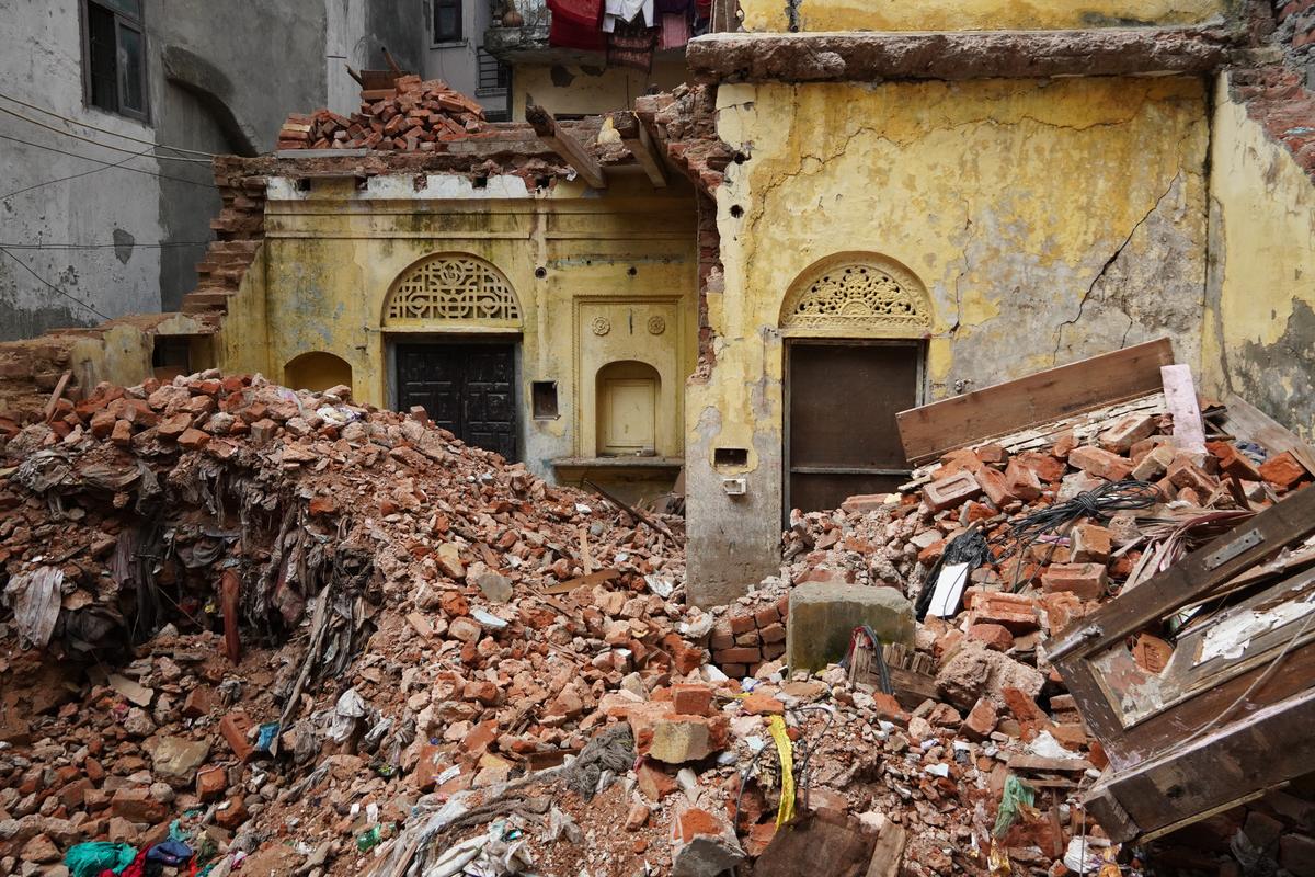
A haveli being demolished in Saidulajab, marking the gradual disappearance of the village’s traditional architectural heritage | Photo Credit: Project Delhi 360: Urban Dehat The bhats , who preserved genealogies and memories of families and their ancestry, provide an important source for recovering histories that may not appear in official records. Collingwood’s The Idea of History , Bloch’s The Historian’s Craft , and Carr’s What Is History remind us that history is not simply found in archives; it is reconstructed through questions, evidence and interpretation. This has an important implication for Delhi Dehat . Its history lies not only in official records but also in village maps, land documents, landscapes, material remains and oral memories. The history of Munirka, as reconstructed in Mhara Munirka: Story of an Urban Village , illustrates this process. The book brings together oral histories, accounts preserved by bhats , old British-period maps, land acquisition documents and surviving structures such as havelis , ponds, wells, chaupals and temples to recover the history of the village. Recovering these sources allows us to see Delhi not merely as a planned metropolis, but as a city shaped by villages whose histories have often remained outside its dominant narrative. The absence of Delhi’s villages from dominant histories does not mean they have no history. It raises a deeper question: whose experiences and sources have shaped the historical record?
The future of Delhi Dehat
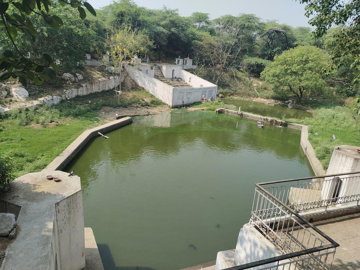
As Delhi plans for 2047, the question is not simply how these villages will be absorbed, but what happens to their communities, heritage, livelihoods and remaining commons. Ram Talab at the Guru Gorakh Nath Temple, a sacred waterbody embedded in the religious and cultural landscape of the village | Photo Credit: Project Delhi 360: Urban Dehat Even the term Dehat deserves reconsideration. Delhi Dehat is therefore not a space outside the city, but a living part of it. (Shekhar Tokas is an Assistant Professor of Urban Studies at Dr.
Delhi’s villages were never leftover spaces waiting to be urbanised. They helped make the city. Will future planning protect their abadi , historic structures and local institutions, or displace them once again? Delhi’s future will depend not only on what it builds, but on what it chooses to retain. The distinction between shahar and dehat obscures the continuities between rural and urban Delhi. Katwaria Sarai village, surrounded by IIT Delhi, the Indian Statistical Institute and the Qutub Institutional Area, still retains its jhod (pond), akhada (traditional wrestling pit), Guru Gorakhnath Mandir , Valmiki Mandir and Daulat ki Haveli. Across Delhi, villages continue to preserve rurality through their built heritage, festivals, rituals, language, food and everyday practices. B. R. Ambedkar University Delhi)