
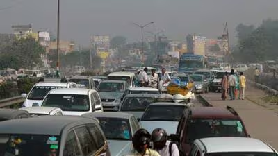
Under spotlight for congestion on Delhi’s arterial road network and worsening traffic congestion, the Public Works Department (PWD) has decided to undertake a comprehensive traffic simulation study and road safety audit covering 2,205.68km of roads across its South, North and East zones in Delhi. The ₹ 11.17-crore exercise will use digital models to study traffic movement on individual road stretches and test possible solutions to congestion before implementing them on the ground.
“The collected data will be fed into specialised traffic simulation software to create virtual models of individual roads and intersections.
These models will allow engineers and traffic planners to recreate existing traffic conditions and test different scenarios to identify the most effective solutions and recommend infrastructure changes and development of new flyovers and underpasses,” official said.
For instance, authorities will be able to assess whether changing traffic signal timings, opening or closing U-turns, introducing dedicated turning lanes, modifying lane markings or changing traffic circulation patterns can reduce congestion. The models will also help evaluate the impact of proposed road widening, flyovers, underpasses and other infrastructure projects before they are taken up.
The study, which is expected to be completed within three months, will cover 1,796 roads across the three zones. These include 270 roads spanning 426.28 km in the South Zone, 1,137 roads covering 1,374.76 km in the North Zone, and 389 roads stretching across 404.64 km in the East Zone. PWD oversees arterial road networks with width more than 60ft while smaller roads are overseen by the Municipal Corporation of Delhi. As part of the exercise, the department will collect detailed data on traffic volumes, turning movements at intersections, vehicle speeds during peak hours, travel times, road geometry and pedestrian movement. Surveys will also cover public transport operations, parking demand and other factors influencing traffic movement. The three month long study will also examine major junctions to identify locations where traffic signals, road geometry and intersection designs are contributing to delays. Possible interventions such as intersection redesign, pedestrian crossings, refuge islands, traffic calming and improved bus facilities will be assessed, officials added.
