
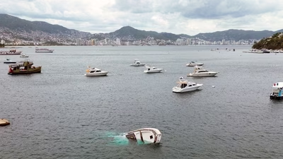
Hurricane Polo has rapidly intensified into a rare Category 5 storm in the Pacific Ocean, with the US National Oceanic and Atmospheric Administration (NOAA) warning of an “extremely dangerous” system capable of bringing torrential rain, flooding and mudslides to parts of Mexico .
Polo’s slow movement could bring significant rainfall to parts of Mexico’s southwestern coast even without a direct landfall. Data collected by the Hurricane Hunter aircraft showed sustained winds of about 180 mph, with stronger gusts recorded. Polo is the third Category 5 storm of the season, according to the BBC report.
NOAA forecast rainfall totals of up to 6 inches (15cm), with some areas potentially receiving as much as 8 inches. The rainfall could trigger deadly flooding and mudslides, while large ocean swells and life-threatening surf conditions were also expected over the following days. The developing El Niño climate phenomenon has produced exceptionally high sea-surface temperatures in parts of the Pacific. Warmer water provides additional energy that can allow tropical storms to strengthen and produce higher wind speeds. Scientists monitoring the Pacific say the current El Niño is now the strongest on record based on daily sea-surface temperatures in a key region of the central-eastern Pacific.
