
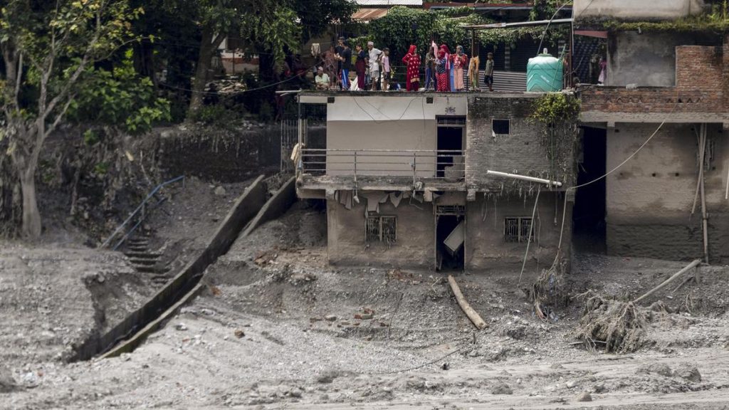
The story so far: A devastating flash flood in the Bhote Koshi–Trishuli river system has killed at least 389 people in Nepal and three in Tibet, while more than 1,400 people are reported missing. Hundreds of people have been displaced in affected districts including Rasuwa, Nuwakot, Dhading, Gorkha and Chitwan No deaths have been reported in India so far, but 288 Indian nationals in Nepal remain uncontactable, with 84 Indians rescued and authorities in Bihar and Uttar Pradesh monitoring downstream flood risks. Roads, bridges, homes and hydropower infrastructure have been destroyed, and search, rescue and relief operations are under way.
The evidence now points to a large collapse of ice and rock high in the Himalayas near Langtang Lirung , rather than heavy rainfall. A mass of glacier ice, rock and debris appears to have detached at about 5,200 metres and fallen roughly 1,200 metres into the Lhende Khola system by momentum, gathering more rock, sediment, ice and water and morphing into a fast-moving debris flow. The rubble temporarily blocked the river and the resulting surge then travelled downstream through the Bhote Koshi and Trishuli systems, affecting communities nearly 100 km away.

That interpretation has since changed. Analysis by the U.S. Geological Survey (USGS) found that the seismic signal originated in a glaciated mountain cliff and was generated by the collapse itself. A preliminary assessment by the National Remote Sensing Centre (NRSC) of ISRO provides important evidence about the origin of the Nepal floods. It provides independent visual evidence of a major physical change at the suspected source area, complementing the seismic evidence that places the ground-vibration source in a glaciated mountain cliff on the north side of Langtang Lirung. However the precise mechanics of the collapse are still being reconstructed. Yes. Satellites can repeatedly measure glacier area, movement, elevation, snow cover and the growth or shrinkage of glacial lakes. Radar satellites can also observe through clouds, while optical imagery provides detailed before-and-after pictures. ISRO, for example, uses satellite data to monitor glaciers, glacial lakes and landslide-dammed water bodies. For all this, their important limitation is that they mostly observe change rather than predict sudden failure. Satellite revisit times, cloud cover, resolution and the difficulty of obtaining measurements in inaccessible high-altitude terrain constrain monitoring. Using a combination of Indian and international satellite imagery, NRSC scientists have mapped the scale of destruction and helped piece together the sequence of events that led to one of the worst mountain disasters in the region in recent years. The collapse generated a massive ice rock avalanche that thundered down a steep mountain valley. The resulting flash flood raced through the Trishuli river system, causing rapid inundation and widespread devastation. Reports from scientists studying satellite imagery have pointed to a cirque glacier collapse and a subsequent ice rock avalanche as a likely trigger for the disaster.
A second seismic event, about three hours later, produced energy equivalent to a magnitude-4.2 earthquake. NRSC compared a pre-event Sentinel-2 image from August 24 with a post-event Resourcesat-2A image acquired on August 26, as well as with an earlier Resourcesat-2A image from April. India today has 56 satellites in orbit. Earlier reporting noted: According to NRSC’s assessment, the disaster appears to have begun high in the mountains of Tibet, where preliminary assessments indicate that a magnitude 4.9 earthquake may have triggered the collapse of a type of a glacier called a ‘cirque glacier’. Scientists compared pre disaster imagery from the European Sentinel 2 satellite acquired on August 24, with post disaster imagery from ISRO’s Resourcesat 2A captured on August 26. In addition, an earlier Resourcesat 2A image from April 4, 2026 was examined alongside the latest post flood imagery to assess terrain changes and identify damaged areas.
Earlier reporting noted: A devastating flash flood in Nepal’s Rasuwa region has drawn the attention of scientists across South Asia, with India’s National Remote Sensing Centre (NRSC), a key arm of the Indian Space Research Organisation (ISRO), carrying out a preliminary satellite based assessment of the disaster. The avalanche is believed to have temporarily blocked a river channel before the barrier failed, unleashing a massive surge of water, mud, rocks and debris downstream. Earlier reporting noted: To understand the scale and impact of the event, NRSC in Hyderabad undertook a rapid geospatial assessment.
Because scientists can often identify hazardous conditions without knowing when failure will occur. This is like predicting which specific straw will break the proverbial camel’s back. A steep glacier may remain apparently stable for years and then fail suddenly.
Temperature, meltwater, cracks, bedrock instability, permafrost and freeze-thaw processes can all influence stability, but there is no reliable equivalent of an earthquake forecast that says a particular glacier will collapse at a particular time.
