
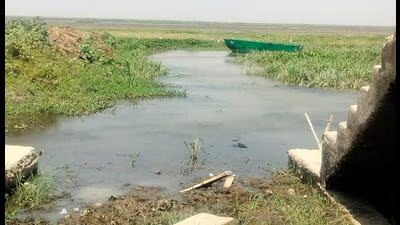
Scientists at Birbal Sahni Institute of Paleosciences (BSIP) have found that Bakhira Lake in eastern Uttar Pradesh holds a natural time capsule. By digging up and decoding ancient lake mud, the scientists unlocked a high-definition record of the monsoon spanning back 25,000 years.
Event Context
The scientists highlighted that the research can serve as a lesson for the Central Ganga Plain in understanding how the monsoon reacts in the region when the earth heats up or cools down. Understanding these ancient natural cycles has given modern meteorologists and climate scientists crucial data to sharpen their computer models, helping them better predict how global warming will impact monsoon floods and droughts in the future.
“The Central Ganga Plain is one of the most crowded and farming-dependent regions on earth. Understanding these ancient climate patterns, by discovering how nature handled extreme rain and massive droughts in the past, can provide policymakers a roadmap to protect modern farming, secure drinking water, and safeguard millions of rural families from future climate disasters,” said Biswajeet Thakur, one of the key scientists engaged in the research.
Scientists analysed the soil’s magnetic properties. When the climate was warm and wet, soil formation created ultra-fine magnetic grains but when it was cold and dry, the grains were larger and more rugged, said Binita Phartiyal, another scientist on the research.
“Variations in minerals also acted as thermometers and rain gauges, showing how severely the ancient Himalayan rocks were worn down by weather. Using chemical weathering scales like the Chemical Index of Alteration, we found how intense past monsoons were,” said Anupam Sharma, a scientist on the research.
By creating a precise timeline using carbon-14 dating, the study mapped the monsoon in five time periods. This shows that about 25,300 to 18,100 years ago the region received a weak and suppressed monsoon with cold, dry conditions and low chemical weathering while about 15,300 to 12,800 years ago the region experienced sudden and massive rainfall along with a warm, highly humid climate and heavy rain and runoff. About 12,800 to 11,100 years ago, the region received drastically weak rainfall and returned to cold, dry, and harsh conditions. The region received peak monsoon intensity and a highly warm and wet climate with intense soil formation about 9,200 to 4,000 years ago, followed by a severe drop in rainfall and widespread aridity that disrupted early human societies during a period ranging between 4,000 and 2,000 years ago, explained Nazakat Ali, a researcher at the institute.
Mahesh G. Thakkar, the director of BSIP, said that the data also offers vital clues on how to refill underground water tables and revive dying wetlands.
Team Analysis
“By mapping out these dramatic historical shifts, scientists can separate natural climate cycles from human-induced global warming. It can guide farmers to adapt their crop cycles based on long-term drought patterns. The research can also become a standard for clearer predictions allowing cities and villages to build better defences against sudden extreme weather,” Ali added.
source
“Policymakers can use this information to develop effective strategies for water saving, flood management, drought preparedness, wetland restoration, and agricultural planning. It also includes valuable suggestions to protect groundwater resources and reduce the vulnerability of rural communities to climate-disasters. Through the current threats to food and water security posed by climate change, ancient lake sediments can act as an environmental archive to help understand the past to plan the future,” Thakkar said.
